 Now we are in Alice Springs and have to decide what we’re going to do. You wouldn’t believe how much there is to do: Botanical Garden, Royal Flying Doctor Service, Anzac Hill, Desert Park, West MacDonnell Ranges, East MacDonnell Ranges, Chambers Pillar and of course Uluru and Kings Canyon – it looks like we’re going to spent some while around here and doing several loop-trips.
 We booked into the Caravan Park (luckily we received one of the last available unpowered tent sites – high season has just started) and went into the city to get the latest information from the visitor centre. We decided to go to the Botanical Garden and spent the afternoon there reading the new booklets. It was a nice sunny day and we combined it with a little walk through the garden. We saw several birds and one actually built its nest and it was not disturbed by the people around. We could come really close (less than 1m) and take our pictures. Some other birds were not so
 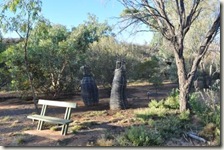 good models… a little green parrot was quite nervous and didn’t stay long in one spot – but we caught him on a picture.
Then we decided to drive up the Anzac Hill for sunset. But as we came closer to the hill we could already see a lot of other people, having the same idea. The car-park looked really full and we walked up the hill – little exercise won’t hurt ;-) After the climb we enjoyed the 360 degree view around Alice Springs. Unfortunately there were no clouds to form a fantastic sunset but it was good anyway – including the hundreds of other tourists (even buses come up there every 10 min. or so).
 Our first loop trip started in a south-east direction. We stopped at the Rainbow Valley Conservation Reserve. It has a really nice camp area with free gas-BBQ’s, picnic tables and a pit toilet. After setting the tent up we went to collect our firewood –
  a cold night might be in front of us – and it didn’t take long to collect enough. Then we walked to the rock formation called Mushroom Rock. Yes, from the right angle this rock actually looked like a mushroom but not a poisonous one as a lot of birds were nesting on the upper walls.
We had a look at the main rock formation as well which is a sandstone cliff. This cliff, although free standing, is part of the James Range and they say most stunning in the right light conditions. First we looked at them during normal daylight so we let our imagine loose and decided one rock looks more like an angry bull [don’t wear anything red in front of it] or like a tame lion – depending if you look from the right or left side at it.


 The second look was of course at late afternoon close to sunset. Yes we watched the sunset and looked into easterly direction. And we agree the rock looks much better at sunset at the coloured rock bands nearly sparkle. As with all rocks the weather had a lot to do with its creation… This rock was created when it was much wetter and iron got dissolved in the stone. Now there are different reds visible (from dark brown over red to orange and finally white). The darker sections contains a lot of iron, the orange sections has less and of course the white sections are ironless. In the end the iron concentration dictated how much the rock eroded or weathered…
 Next day we left to our next destination. We had to follow the Hugh River Road and cross the Central Australian Railway. We stopped and even tried to locate a coming train… No worries, it was safe to have your ear on the track – no train was near so we kept going. Just before reaching the Chambers Pillar Historical Reserve we put our sand-flag up as there were some dunes to cross, but they were really easy and Tom was still used to them ;-)
This time we didn’t had to rely on our GPS as the road was well formed and the pillar was towering in the distance. The main feature is a 50m high sandstone pillar which stands tall and on its own.
 Chambers Pillar has high importance for the European settlers as well as for the Aboriginals. For the early settlers (at around 1860) it was a landmark on their long travels from Adelaide – understandable how tall it is. Maybe it was even taller as it might have eroded a little bit in nearly 150 years. You find a lot of evidence as the settlers left a record in the sandstone – it was signed – as did John Ross and Alfred Giles in 1870 and a Mrs but the “S” is written the other way around. Now it’s illegal to sign the rock as this adds to the erosion of the rock.
The Aboriginal Significance is to be found in their dreamtime story about the Gecko ancestor Itirkawara. This gecko ancestor was a powerful and quite violent men who ignored some of his tribes rules by marrying a girl with the wrong skin color. They were banished and turned into the rock formations – he became the pillar and the girl formed the rock called castle rock close by.
 It’s possible to find a rare gecko species – probably one of the descendent of the Gecko ancestor. This gecko is called knob-tailed gecko and is quite small. Most visitors won’t see it as it’s mostly active during the night and really good camouflaged – light brown to beige in colour – hardly to be recognised in the sand. But we had luck and found one (something was crawling on the sand ah by the way the sand was beige in colour and not red); before it went to the next hiding spot under a bush, stone or even buried in the sand.
We walked the probably 1.5km loop walk around the pillar which provided some good views and a little rock with not so old signatures. The viewing platform at the base was climbed after 50 steps and then we had a look at the old signatures – they are in good condition and visible. Unfortunately you find newer ones as well even though it’s quite dangerous to get to the base.
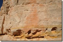
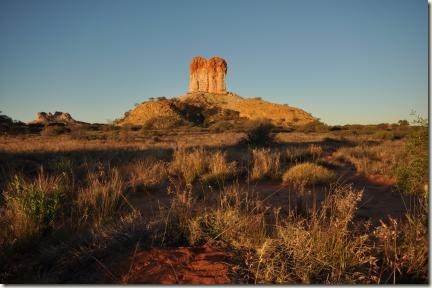 As you might already expected the pillar shows it best colours at sunrise or sunset when it glows like a burning ember. It looked good although a little bit dust or some clouds might have increased the view. While we were watching the pillar we had several discussion what the pillar looks like – but this time I leave it to your imagine please give us some feedback.
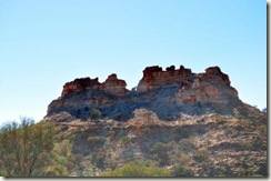 You can walk around Castle Rock as well which we did in the morning. We came across another rock which gave us some ideas to play around with the camera and ourselves… During the walk we saw several nice flowers which looked to be really soft but actually they were quite hard to touch. I think they are called “cat tail”. The rock looked a little bit different and we noticed more and more features the longer we looked at it.


Finally it was time to head back to Alice Springs but with a stop in between. The stop was at the Ewaninga Rock Carvings. At this place you walk around several rock carvings.
Goodbye,
Tom and Anja


