Wednesday, January 12, 2011

7. – 9. December

I’m walking, yes I’m walkingfamily portrait

We left Albany and took the scenic route to Denmark. On the way we kiss the turtle could have stopped at a blueberry plantation but it was closed so we continued to Denmark. Our fist stop was the barometer exhibition. There are around 20 barometer on display and it was possible to play around – create a vacuum and see what happens, ring a “bell” with a barometer. The tallest barometer was 12m high and water went up and down the pipe. We raced it to the top of the pipe and we were fit but the water was boiling… quite fascinating. Next to information centre was a  little showroom of wood turners – we watched them for some minutes.

river walkThen it was time to stretch our legs. We drove to the point where the inlet/river reaches the ocean which only happens at high tide as we only saw a sandbar between them. After that walk we explored the loop walk in Denmark which was nice although it turned out to be a return walk as the last bit was flooded.
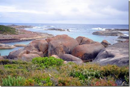
elephant cove Elephant Rock was the next stop which you could only spot from the right  angle. We arrived and had a look atwilliam bay np stranded the beach first. Then my dad and I started to explore the elephants. We had to go around one big rock and down some slope before we were standing before the herd of elephants.

Now it was time to pitch the tent and we drove to a community run camping place close to the beach. We managed to get the spot furthest away from the beach (the beach was our morning exercise) which was nice and quiet. It was allowed to have a camp-fire but we didn’t have any wood nor wanted to buy a complete wheelbarrow so no camp-fire.

tree top walk tree top walk 4The Tree Top Walk was fantastic and one of the places my mum was really keen to see. The walk is approx. 700m long and up to 45m high up  in the trees. Sometimes the pathway swung in the wind! They had some informative signage which explained that the trees survive fires well and just establish a new canopy beneath the old one. We did the walk twice – we had to get the pictures from all angles.

hug the tree Adjacent is the Ancient Empire Forest – several tall and old trees (mainly red and yellow tingle trees). These trees roots don’t grow into the depth they cover a lot of ground so we walked on boardwalks. Sometimes we had to walk through the trees – there was no other way to continue the path.

We had a quick picnic at the Coalmine Beach andswarbrick 2 headed to the Swarbrick Sculpture Walk within the Walpole Nature park. To enter that park you nearly  had to open a dunny-door but luckily it was just standing next to the pathway. But then we came to a mirror which was nearly 20m long and we had to find the gab. To see all sculpture we had to keep our eyes wide open and the head swirling around as they were high up in the trees, on the ground or in the bushes.

swarbrick 3fernhook 2This night we camped at the Fernhook Falls and had the first camp-fire for my parents! The fire was used to re-heat our rissoles. This camp-area is  managed by the DEC and offered several tent/campervan sites plus two huts. Unfortunately I don’t know how the huts look like as they were already occupied when we arrived. We walked to the falls snake gully but not much water was running. I’m not sure if the level should be higher or not. From May/June till October/November you could launch your canoe and paddle downstream… But of course it’s already December we didn’t launch anything.

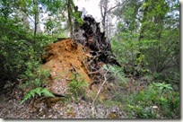
jungle step We continued to drive the tourist drive “Great Forest Tree Drive” and stopped at a little cove. After a little driving experience for my dad we stopped in Northcliffe and walked the Twin-Karri Walk. This tree looked like a Siamese twins – the trunk was connected. On the other side the walk led through Karri and Marri forest. It was a bit like walking in a jungle. If a tree fells down it will not be moved away. They just made a little gab or some steps into the trunk so the crossing was not too difficult.

bibbulmum track There is also the option to walk nearly 1,000km from Perth to Albany. It’s the 8-week adventure track called Bibbulmun Track. Of course we didn’t walk the whole track we just crossed it several time and walked some paths which used the same track.

Always one step after the other,

Keep walking, MaPa, Tom and Anja

P.S. This time the reading is not over… I thought to provide some more pictures for you to have a look at ;-)

driving the good old car 1 driving the good old car 2

driving the good old car 3 jungle root

tall karri ancient forest 2 ancient forest

tree top walk 5 twin karri tree top walk 4

swarbrick 1 kookaburra

tree top walk 3 tree top walk 2

william bay np who is hiding

Saturday, January 8, 2011

6. December

Whale Worldww cheynes4Australia was a whaling nation and many cities hat their own whaling fleet and whaling stations – like Albany. The Southern Right, Humpback and Sperm Whale were hunted and all live in the waters surrounding Albany. The Sperm Whale prefers the deep waters of the Continental Shelf which lies at around 30 nautical miles from Albany. It was not so profitable to hunt Sperm Whale probably one reason it could be hunted longer than theww warning other whales. In 1978 all whaling was forbidden in Australia and several cities lost part of their industry and most whaling stations closed and got demolished. The whaling station in Albany was re-formed into a museum and we had a look at it. The area is quite small but anyway we spent several hours there – there was so much to see, discover, explore and learn.

And our visit begun. First we had a look at the Colin Green Heritage Gallery which shows some photos of the whaling operation as well as displaying some whaling artefactsww early version of engine like flensing boots. Just after 10 minutes it was time to join the tour guide. Most times you get more  information with a tour guide than just visiting on your own. The tour started at the Boiler House where a working triple expansion steam engine is. The engine is still in working conditions as the demonstration showed.

Next stop was the Flensing Deck where the dead whale was towed on deck and the blubber stripped off. The whales were hunted during the day ww whale towingand towed into the bay where they stayed overnight. If the hunt was  successful they would radio in and the Flenser could be contracted for the next day. They started early and had to get the whales onto the deck (beating the lurking sharks). On the deck the real fun started – to stripe the blubber. We listened to an audio broadcasting the atmosphere and noises. I don’t think that to be a Flenser was a sought after job – it was very dangerous and no insurance cover possible at all. They had to climb onto the whale wearing the gum-boots with the spikes and use their ww cookers knifes. Don’t think of a knife for cutting meat or bread it looks more like a golf-club but completely of metal and a sharp cutting edge. They were never able to get the smell of their clothes…

Then we moved to the Cutting-Up Deck. The blubber had to be cut into smaller pieces otherwise it couldn’t be thrown into the cookers. In the cookers the whale is reduced to a liquid and the oil is extracted. They tried to use as much as possible of the whale including the bones. The bones were crushed down. Of course they had to separateww demonstration the head from the body using the head-saw. The extracted oil was stored in the huge oil tanks before it got to the oil tanker. The tanker were filled by a huge pipeline which was checked for leaks before any filling. The oil was too valuable and too much hard work involved to waste any. Of course did the dead whales attract sharks and they would have a feast. But that never lasted long as the sharks were killed then. Any shark bite could tear 1/5 of the bladder so the whaler tried to ‘recover’ it by killing the shark.

We also looked into the engineering and blacksmith workshop which now houses whaling artefacts and other equipment (boats, flensing knifes, flensing boots…). Some pictures are also displayed mostly about the whaling operation and how busy the flensing deck looked like but I preferred the picture of the Giant Squid. The squid was eaten by a Sperm Whale. ww giant squidThe Panorama Tower Gallery was an interesting place. I nearly got lost as it had 4 entrances. The gallery provides an pictorial and graphical insight into the antics of the whalers from 1950 to 1978. The pictures showed several crew members as well as some history about this whaling company. We learnt that they originally only owned one boat but were able to get two of a Queensland company which had to close in 1963ww full speed ahaed when the Humpback Whale came off the hunting list. Later they were able to purchase the fourth vessel. All boats have a different story how they “ended” their life – Cheynes I was destroyed and used as a spare-parts, Cheynes II was sold to a private investor who wanted to establish a restaurant (but nothing happened and the vessel sunk), the Cheynes III is tourist attraction in its own as it’s a diving wreck and Cheynes IV is still at the whaling station included in the exhibits.

Four buildings are used as a movie theatre. One workshop is now housing the Spectravision Theatre which explains the life of a whaler and his family – how the normal day of life was. They also feature how theww skeletton 2 information of the whaling station closure effected the families. The other movie theatres are in the oil storage tanker. One is about the history of Australian Whaling, one about the relation between sharks and whalers and the third is about the whales. It’s called “Giants exist” and is a 3D-movie. I really liked it and of course everyone tried to touch the whales.

ww blue whale jaws Then we went into another “Giant” shed – we had to walk underneath a gigantic skeleton – ok it was only the jaw bones of a blue whale but really big. Inside the building were more skeletons to see. We had a look at a 22m Pygmy Blue Whale (the jaw bones were much smaller). There are more skeletons from whales and dolphins. All animals are found in the waters nearby. A head of a Humpback Whale was on display as well – the “teeth's” were visible – this material was used for corsets.

Our final look took us onto the vessel Cheynes IV. It was possible to walkww harpunists into many rooms except of the engine compartment. We had a look at the different quarters from captain, second mate to standard crew and of course there were lots of differences. And K-Leun was in action again – he spotted a whale and the 1. WO had to hurry down the catwalk to assist the harpunists. Yeah, I know someone has to stay in control of the vessel ;-)

ww giving directions1 ww giving directions 2

Thar she blows,

Ahoi, MaPa, Tom and Anja

ww skeletton 1

Friday, January 7, 2011

3. – 6. December

Porongurup National Park and Albany porongurup mountains2 Second start for our tour through the southwest of WA. This time we went via the Albany Highway – hopefully we won’t find any troubles with the van and 4 people ;-)

mt barker lookoutWe camped at a free site close to Mt. Barker. During the night it started to rain and got quite chilly. The tourist information in Mt. Barker is only open from Thursday to Sunday so luckily we arrived on a Saturday and could gather some information. First we went to the lookout on Mt. Barker and enjoyed the vistas in between the showers. We could see all the heavy rain clouds but it didn’t start to rain while we were outside.

tree on the rocks Next stop was the Porongurup National Park and we were hoping for a nice walk with no rain – we had our fingers crossed. There are several hikes so we couldn’t decide which to take… So we just walked to the main attraction – the tree on the rock. It is a funny sight. The tree is really growing out of a rock or on top of a rock. And believe me the tree is tall. We decided to climb the rock (it was only 1m high) to have a closer look at the tree and we saw that the tree is breaking the rock apart. I think some microorganism are responsible that the tree can grow on the rock.

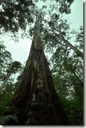
tall taller tree 1 It hasn’t starting to rain yet so we kept walking. While walking we saw more tall trees – mainly Karri, Marri or Tarri trees (I can’t recall 100%). Anyway the trees can grow up to 90m high and reach an age of 400. Such tall trees are also wide – all 4 of us were needed to hug the tree. Some trees even offer some kind of shelter – a fire or some fungus created a hole…

tall tree 2

The walk went uphill and offered several views – in the north to the  Stirling Ranges and in the south to Albany (of course you need clear skies to see). But we could only recognise the coming rain – it looked like the next shower was not far away. But we had luck and it didn’t rain. Unfortunately we had to return the same way as we must have missed one turn-off. Back at the van we had a little coffee and tea break.

porongurup mountains3 Next stop was Albany and we had a look at the region. There are some albany harbour hills and several walking tracks along the coast. First we went to the war  memorial on top of one hill and had nice views of Albany and the harbour. We also saw some bobtails and other lizards – they must have liked the sunshine after two days of rain. And my mum was afraid not to see any wildlife. It’s also possible to track the hill with your  mountain bike – the downhill track was just recentlydinner time finished but we saw no biker. On the other side of the hill was a military museum but we preferred to walk along the beach and coast. Along the coastal walk were several lookouts and some wild flowers to be seen. That evening we enjoyed a pizza at the beach.

Albany’s coast is marked by the Southern Ocean, the bay wild oceanand the river. There are only two places in WA which have a natural sheltered harbour and Albany is one of them. Albany was actually the first settlement in WA but couldn’t not compete with the better (logistic) location of Fremantle and Perth. The coastlines are really different; the bay is relatively calm but not easy to navigate, the river part is good for swimming and the ocean coast is rugged and rough so that some blowholes were formed. Unfortunately they didn’t blow so I’m not able to decide which are better. But we had a look at the natural bridge and they are similar in the south and up north.

flowering banksia

More to come, stay tuned,

Cheers, MaPa, Tom and Anja

mt barker looks porongurup mountains albany natural bridgealbany foreshore 


Sunday, January 2, 2011

29. November – 2. December

Wave Rock and Kalgoorliewave rock 1Finally the road trip had started and we drove east. We planned to reach Hyden that day but unfortunately it came different than planned. The littleplayful parents car broke down and we had to stay in Corrigin and to split our team. Tom had to go back to Perth while I continued with my parents.

So my parents and I had a look at the Wave Rock. The rock was a massive sight although it was much smaller than I anticipated. The wave is 15m high and around 120m long and it looks much much bigger on all postcards. We did the Wave Rock walk wave rock 2which leads underneath the wave and up on the cliff and escarpment. We were wondering how close to the  wave edge it is possible to walk – we saw some kind of fence. We used the stairs to climb up the escarpment and noticed that the fence was really a fence but not to protect people. The purpose was to guide the rainwater into the  catchment dam. There were several sign which explainedhands up high the flora and fauna. We even noticed a little wave rock on top of the escarpment. The Wave Rock contains of granite which did not erode. The other “stones” eroded which exposed the wave. I guess the scientists are not 100% sure why there is actually a wave (the curve on top of it) but I don’t know it any better. There are some further walks but we only drove to one cave to see some aboriginal art.

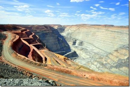
hyden and the localsWe then headed to Kalgoorlie (couldn’t take the direct route as this was gravel road… so we had to take the 150km longer way) but as long as you reach your destination is all ok. We stayed at a free camping spot – first free camping ever for my parents!!! superpit 4Unfortunately we arrived to late in Kalgoorlie to have a look at the  under-ground mine or to witnesssuperpit 5 the blast at 1.00am. But nevertheless we had a look at the Superpit - the open cut mine! And it is massive. We probably looked at it for 1.5h there was so much to recognise and see. The big mining trucks looked like matchbox-cars and needed quite long to exit the pit but were racing back down. We also saw some bagger and cranes which looked tiny but the normal car next to it looked even smaller.

superpit 2 superpit 3  size chartThe lookout is also informative as there are many signs telling you about the mining operation, how it all began, what they do for the environment and which “hardware” they use. One sign is dedicated to the trucks showing how many are in use, how much they weight and costs (purchase price and running costs).superpit 1

Our next stop was at … which was just for 30 minutes or so. The place shows some damaged equipment of the earthquake. You could see the bended railway tracks, the exploded or imploded water pipeline and other pictures of the damage. In the end we arrived in Fremantle again to get Tom onboard and to travel together.

More adventures will come,

Cheers, MaPa, Tom and Anja