Kakadu National Park
Our first task was to buy the 14-day pass. Every interstate and international visitor has to buy an entry pass (as there were no controls not everyone gets one) – I guess Kakadu will soon be  known as Kaka-don’t again. Luckily we were allowed to use the pool and showers of the Aurora Hotel, it did pay off to ask. We then headed to the camp area and had the Red Lily Billabong in mind. But these camp spots were so close to the water we decided to have a look at the Bucket Billabong as well. We than camped at the Bucket Billabong as the water was 1.5m below the camp-area. So we assumed the crocs won’t climb it. In the morning we were assured that crocs do live in the billabong as one swam in the water.

 Then we headed to Ubirr via the Visitor Centre and Jabiru. We had a look at the several rock paintings. We recognised paintings of turtles, snakes,
  ships and fishes as well as X-ray paintings of human beings. A lot of these painting originated in the freshwater period around 1500 years ago. But there is also a painting from a Tasmanian tiger which became extinct over 2500 years ago (at least in this region). We also enjoyed the Nadab lookout – overlooking the floodplains.

Next we stopped at the Cahill’s Crossing – the East Alligator River crossing connecting Kakadu NP with Arnhemland. This crossing is only passable during low tide and only with the right permission. And we arrived at high tide, it was still possible to see the water moving inland. Two cars were waiting in front of the crossing, although I’m not sure if they were waiting to cross or just parked their car as they were fishing… We saw several crocs in the water. This area is like heaven for them. Most fishes are not strong enough to withstand the current they get swapped away. So the crocs just have to wait in the right position and the fishes are getting directly into their mouths.
 Another rock art site is at Nourlangie. It’s known that this area was used for the last 6000 years although some founds could be dated 20000 years back. The rock paintings were re-painted in 1964 as they were so faded. The circuit walk leads through the rocks along the different galleries before you can start the lookout walk. From the lookout we had fantastic views to the surrounding hills and into the woodlands.
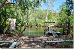 Then we headed out towards the Twin- and Jim Jim Falls. This area is only accessible with a 4WD as you have to cross the Jim Jim Creek still standing at 50cm depth. And we had to take a little boat shuttle to come close to the Twin Falls. But you still have to walk a little bit of several rocks and even over water (of course there was a walkway)
 to come to the plunge pool. Unfortunately it’s not possible to swim – the creek is still connected with the other waterways and not all crocs have been removed. The ranger informed us that they spotted 8 crocs during the wet season but only 2 could be relocated so far. But there was no croc in the traps so the fishes enjoyed the bait… There are several turtles and they had their nesting season so that the hatchling come out for the wet season.

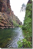 Now we went to the other waterfall – Jim Jim Falls. And we could swim in the plunge pool. The waterfall didn’t have any water anymore so part of the creek was dried up and no croc could enter the pool area. It was a hard 900m walk – climbing over rocks and stones. But we had our swim! We even put our shirts into the water and they were completely dry when we returned to the car.
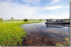 We only stopped briefly in Yellow River– the big wetland with a huge crocodile population and several cruises on offer. We didn’t go on any cruise we just watched the crocs and birds from the walk.
 The next day could be called “find as many swimming holes as possible”. First we went to the Maguk area and walked to the plunge pool. Of course the walk went of the rocks and stones still through a little bit of water and then we reached the pool. It was a big plunge
  pool and the water fall still had water. But we didn’t swim to the fall as the water was cold, deep and quite dark. Additional a lot of backpacker tours turned up and they used all the remaining space.
 In the end we reached the Gunlom area where you could swim as well. This time we just had to walk 200m on a flat surface to reach the pool. We cooled a little bit down before we started to explore the rock pools on top of the
  fall. The walk was a steady walk and we enjoyed some wonderful views before reaching our destination. There are five different rock pools and we just used two and had company of several fishes. We could have investigated the gorge but we forgot our inflatable rings and didn’t dare to go adventurous. Then we had another night in Kakadu and returned to Darwin.
 Some part of the Kakadu National Park is called “sickness country”. The Aboriginals believe that you get sick on entering these areas – it is said you disturb some kind of ancestor. And there is a scientific reason behind; these areas contain radio active materials like uranium which is mined.
Bye, bye
Tom and Anja


